News & Events
Social Networks: Exploring and Visualising with Gephi
Do you want to learn a new skill in this Autumn Term? Network analysis offers an interesting way of exploring and visualising networks between social, economic, and political actors.
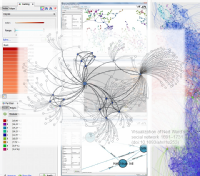
In this workshop, we explore how to use the Gephi software to visualise and understand a 17th Century network. We will explore the network and consider what the patterns in the data suggest. You are encouraged to prepare for the session by reading the links from the Workshop Web Page, but this is not essential if you do not have time beforehand.
This workshop will be led by Dr Godwin Yeboah and Dr James Tripp who are Senior Research Software Engineers and part of the "Research Computing" team in the Research and Technology Platforms (they are also part of the Centre for Digital Inquiry).
Please read more (and register if interested or share) using the following webpage.
Social Networks: Exploring and Visualising with Gephi
Do you want to learn a new skill in this Spring Term? Network analysis offers an interesting way of exploring and visualising networks between social, economic, and political actors.
In this workshop, we explore how to use the Gephi software to visualise and understand a 17th Century network. We will explore the network and consider what the patterns in the data suggest. You are encouraged to prepare for the session by reading the links from the Workshop Web Page, but this is not essential if you do not have time beforehand.
This workshop will be led by Dr Godwin Yeboah and Dr James Tripp (of the newly formed Information and Digital Group Technology for Research; they are also part of the Centre for Digital Inquiry).
Please read more (and register if interested or share) using the following webpage.
How to create a map for print and web using QGIS
Do you want to learn a new skill in this Spring Term? Have you ever thought of creating a basic map for a presentation or publication? What about creating an interactive web map for your own website or just to experiment how that will look in an internet browser? If you answered yes to any of these questions, and you are in Warwick, this workshop is for you!
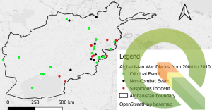
In this introductory course, we will give you an overview on how to use different cartographic techniques to effectively present outcomes of digital data exploration using QGIS software. We assume no prior knowledge of GIS (Geographic Information System) and will explain how to get data into the GIS as well as how to produce maps using data. The workshop lead is Dr Godwin Yeboah (g.yeboah at warwick.ac.uk).
How to create a map for print and web using QGIS
Do you want to learn a new skill in this Autumn Term? Have you ever thought of creating a basic map for a presentation or publication? What about creating an interactive web map for your own website or just to experiment how that will look in an internet browser? If you answered yes to any of these questions, and you are in Warwick, this workshop is for you!
In this introductory course, we will give you an overview on how to use different cartographic techniques to effectively present outcomes of digital data exploration using QGIS software. We assume no prior knowledge of GIS (Geographic Information System) and will explain how to get data into the GIS as well as how to produce maps using data. The workshop lead is Dr Godwin Yeboah (g.yeboah at warwick.ac.uk).
Networks: A Skills Workshop
Network analysis offers an interesting way of exploring and visualising networks between social, economic and political actors.
This workshop will be led by Dr Kate Davison (University of Sheffield, History Dept.), assisted by Prof Mark Philp, Steve Ranford, and his colleagues Godwin Yeboah and James Tripp (of the newly formed Information and Digital Group Technology for Research; they are also part of the Centre for Digital Inquiry).
The concept and utility of social network analysis will be explored, and some of the software illustrated. The session will be hybrid. You are encouraged to prepare for the session by reading the Kadushin listed in below webpage, but this is not essential if you do not have the time beforehand. Although this is an event organised by the History department's Early Modern and Eighteenth Century Centre, it is open more widely to others in History and more widely. Please read more (and register if interested or share) using the following webpage.
Introductory Social Media data collection and Analysis using R
How can you collect and examine social media data? In this workshop, we will use the R statistical programming language to download and begin to examine social media data from Twitter and Reddit. We look closely at the data and then zoom out to consider overall trends. The aim of this workshop is to introduce the collection and analysis of social media data. The materials for this workshop are available on GitHub here.
The workshop is available for Warwick staff and students, who can sign up here. If you have any queries then please contact james.tripp@warwick.ac.uk
How to create a map for print and web using QGIS
Do you want to learn a new skill in Term 2? Have you ever thought of creating a basic map for a presentation or publication? What about creating an interactive web map for your own website or just to experiment how that will look in an internet browser? If you answered yes to any of these questions, and you are in Warwick, this workshop is for you!
In this introductory course, we will give you an overview on how to use different cartographic techniques to effectively present outcomes of digital data exploration using QGIS software. We assume no prior knowledge of GIS (Geographic Information System) and will explain how to get data into the GIS as well as how to produce maps using data. The workshop lead is Dr Godwin Yeboah (g.yeboah at warwick.ac.uk).
Introduction to QGIS: Creating a map for print and web
Do you want to learn a new skill? Have you ever thought of creating a basic map for a presentation or publication? What about creating an interactive web map for your own website or just to experiment how that will look in an internet browser? If you answered yes to any of these questions, this workshop is for you!
In this introductory course, we will give you an overview on how to use different cartographic techniques to effectively present outcomes of digital data exploration using QGIS software. We assume no prior knowledge of GIS (Geographic Information System) and will explain how to get data into the GIS as well as how to produce maps using data. The workshop lead is Dr Godwin Yeboah (g.yeboah at warwick.ac.uk).


