
Interpretative Session Report: Social Designs for Planetary Observation
Smartification of the Earth: Social Designs for Planetary Observation
Session Report
"Build Your Own Planetary Observation Station"
Interpretative session (online), July 2026
On 14 July 2026, the Social Designs for Planetary Observation project convened an interdisciplinary group of Earth observation scientists and scholars, design researchers and social scientists for a 90-minute interpretative session. The session used creative methods of participatory prototyping to explore the socio-technical, environmental and material dimensions of satellite-based planetary sensing.
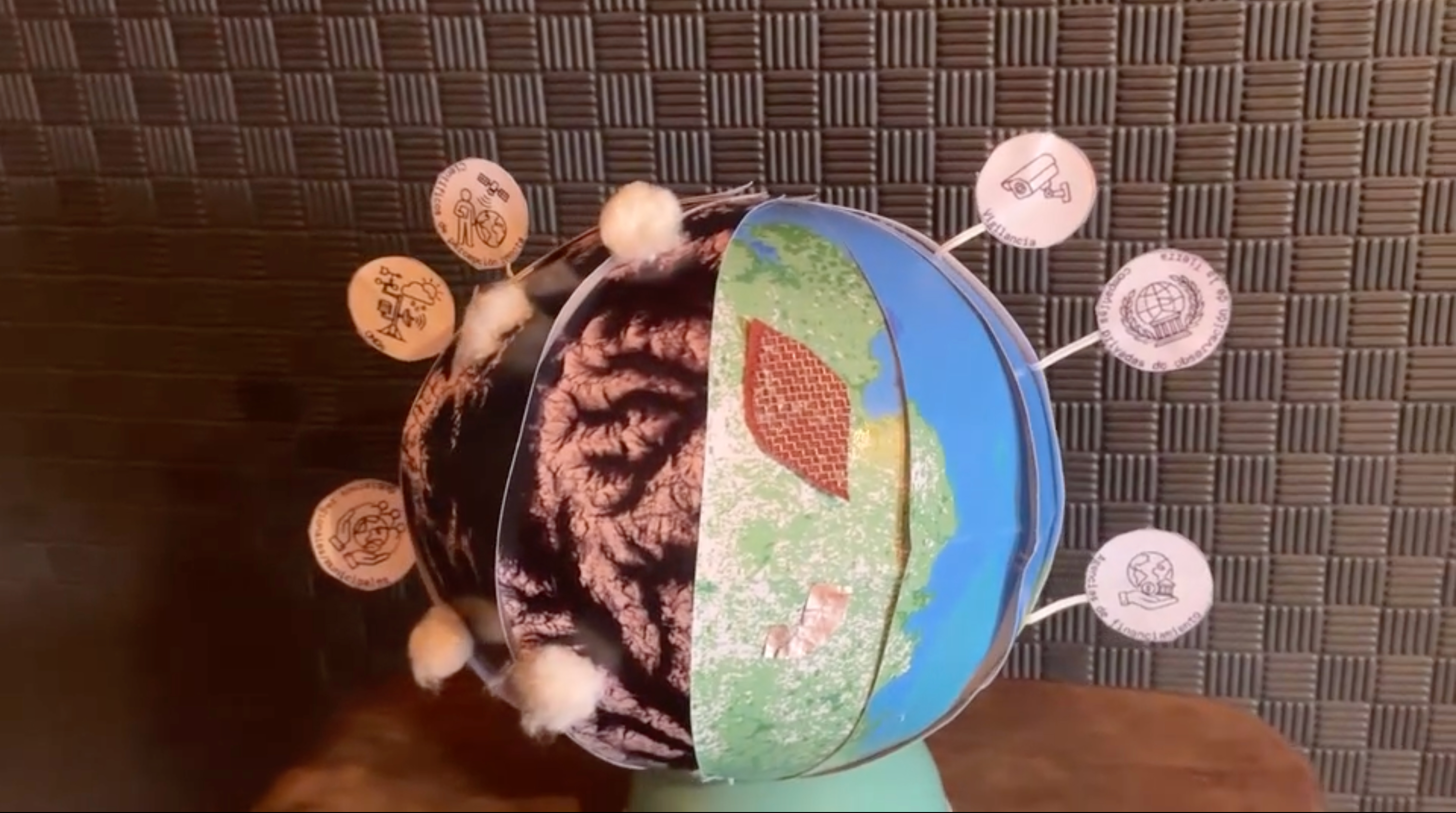
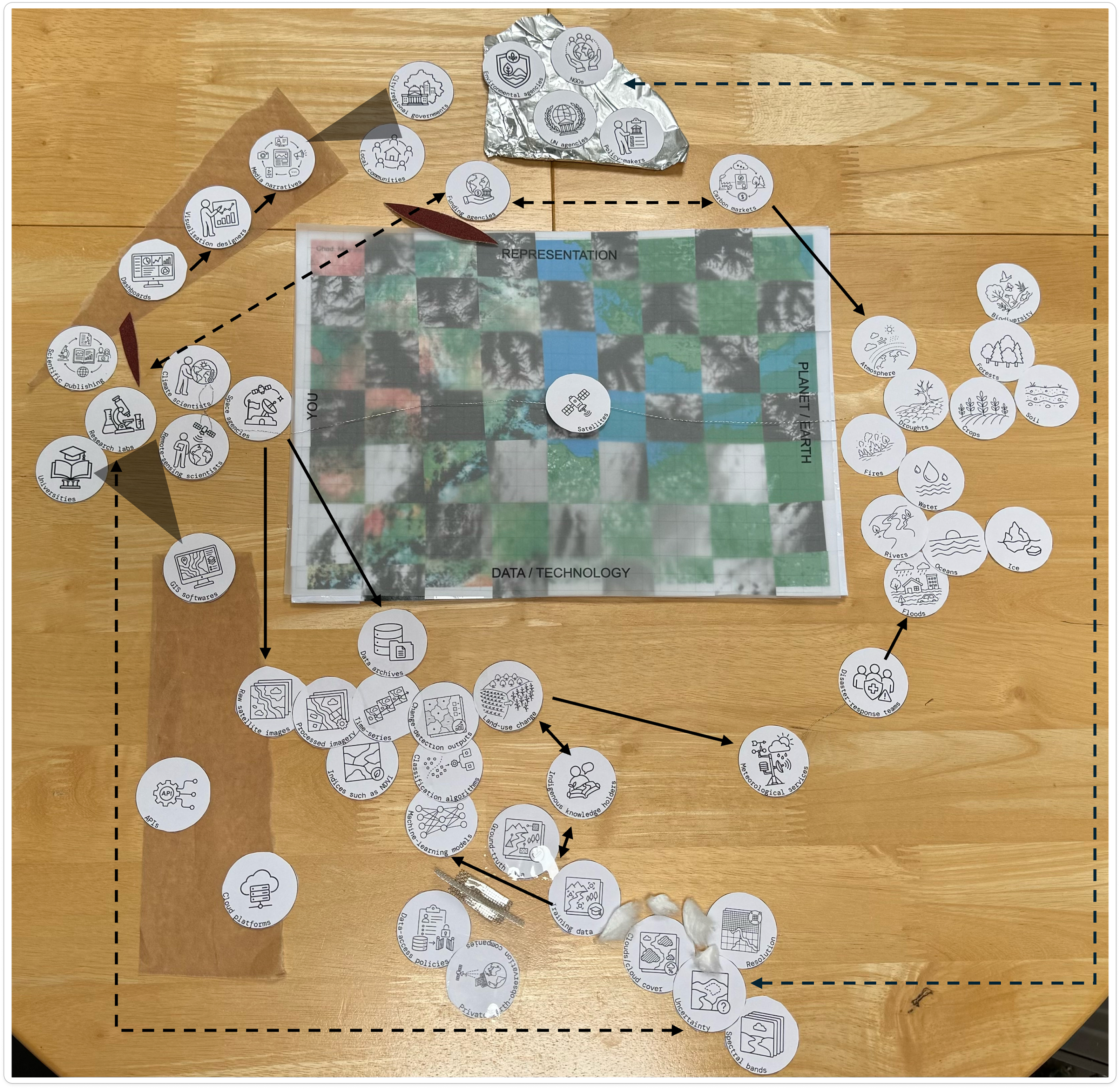
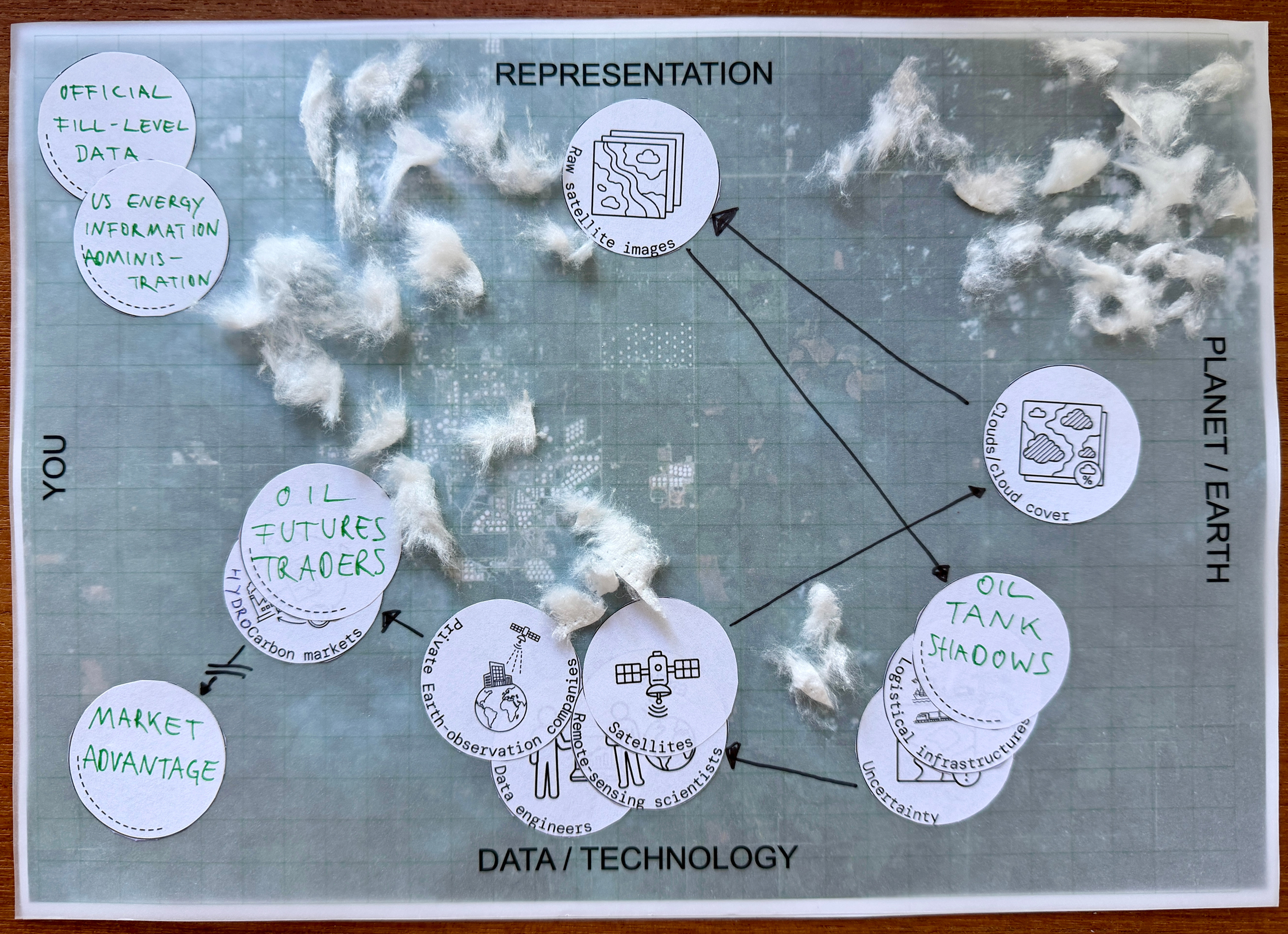
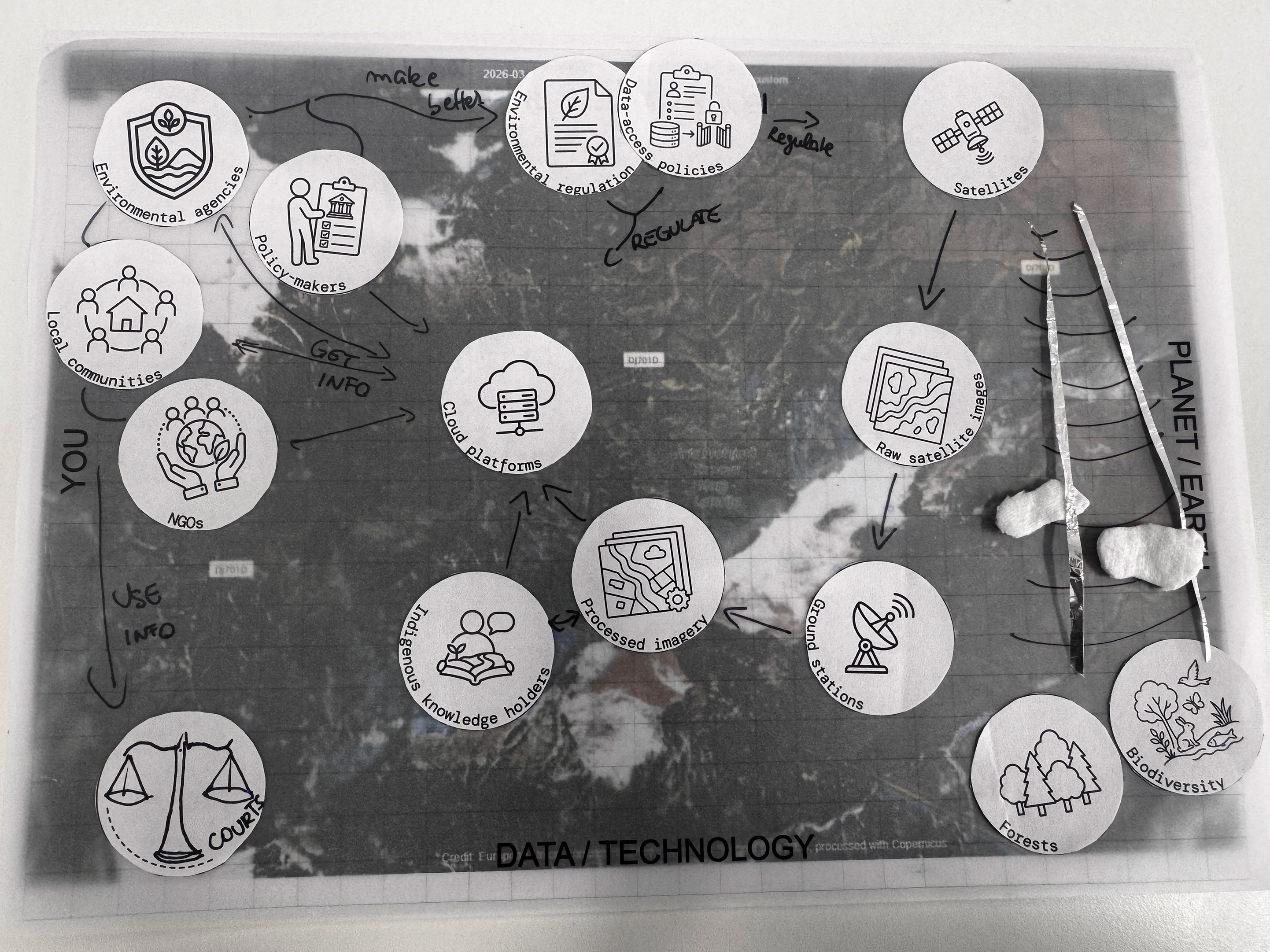
Figure 1: Planetary observation stations created by participants and discussed during the interpretative session. Credits, from left to right: Diego Rivera, Freya Muir, Stefan Schäfer and Oxana Carina Gorgan.
During the session, participants examined the “planetary observatory stations” they had created prior to the session, using materials such as gauze, metal mesh, stickers, cotton, and printed images, to represent their own experience of the science and technology of Earth observation. In exploring prototypes collectively, participants reflected not only on what satellites reveal, but also on the infrastructures, environments, labour and political economies that make planetary observation possible.
The session included three different interpretative activities: Describe, Position, Evaluate. First, participants described their stations and the specific knowledge, interests or experiences that shaped them. Second, they positioned their stations along two axes—from “Heavenly” (observing from orbit) to “Terrestrial” (observing from the ground), and from “Representing” to “Transforming”—to map the diverse orientations within the group. And, third, they interpreted their own and others’ stations by connecting them to anonymised quotes drawn from the broader project. This phased approach enabled a gradual deepening of reflection and conversation, moving from individual show-and-tell comparative positioning to critical interpretation. The following common themes emerged:
A prominent theme that was reflected in nearly all the stations was the profound inequality in access to Earth observation data, particularly between public, freely available, cost-efficient products provided by agencies like the European Space Agency (ESA) and high-resolution imagery reserved mostly for military and commercial use. Participants from Chile described how funding constraints force them to adapt their research methodologies to lower quality data sets, which in turn shapes the scope of questions they can ask. This was not only seen as an economic tradeoff but also presents an epistemological constraint—data access determines what can be known, and by whom. A 3D representation of an Earth with a light and a darker side captured this vividly, capturing the sharp divide between “one planet, two resolutions”, illustrating how the same geographical object appears radically different depending on who pays for the view. The consequence, as several participants noted, is a methodological and epistemic asymmetry that reinforces existing geopolitical and institutional hierarchies.
The materiality of observation infrastructure emerged as a second major line of inquiry. Participants used gauze to evoke the veiling and hiddenness of data centres, logistics networks, and processing chains that lie beneath the polished surface of satellite imagery. Metal mesh, by contrast, signified technological barriers and firewalls—both literal and figurative—that separate private, high-value data from public accessibility. Cotton clouds were employed in one station to illustrate how physical atmospheric conditions can interrupt satellite data flows, with tangible economic effects: in the case of oil futures trading, cloud cover over specific storage facilities reduces the accuracy of satellite-based estimates, thereby affecting market returns. These material choices revealed how the seemingly immaterial realm of digital observation is in fact deeply entangled with physical infrastructures, environmental conditions, constraints and impacts, financial systems, and Earthly phenomena.
A third recurring theme concerned the relationship between the relevance and value of planetary perspectives and their connections with local knowledge. Several stations highlighted pathways from satellite-based representations to place-based communities, through layers of interpretation, regulation, and action, emphasising that Earth observation becomes most powerful when combined with indigenous and locally grounded expertise. Participants highlighted that validation, calibration, and land-use monitoring increasingly benefit from engagement with local actors, which do not only provide ground-truthing but articulate environmental relevance which satellite-based observation alone cannot offer. One station mapped a flow from tacit local knowledge to political actors to formal regulation and finally to concrete interventions such as flood prevention, illustrating that the value of Earth observation cannot be reduced to the images themselves but derives from their articulation of multiple actors in situ. These tensions and risky connections between the universalising gaze of the satellite and the situated, contextual knowledge of place were a persistent and generative theme throughout the discussions.
The session concluded with reflections on future collaboration. In future work, we would like to focus on understanding how satellite images are mobilised and mobilise different communities and audiences through their terrestrial infrastructures of funding, minerals, data centres, AI models, scientific expertise, and regulatory frameworks, and how this diffracts and dramatises the themes that emerged from our joint prototyping work. The aim is to examine what arrangements and translations are needed for Earth observation not to be treated as a given technological fact, but as a socially and materially mediated practice that is always entangled with questions of access, equity, interpretation, and local knowledge.
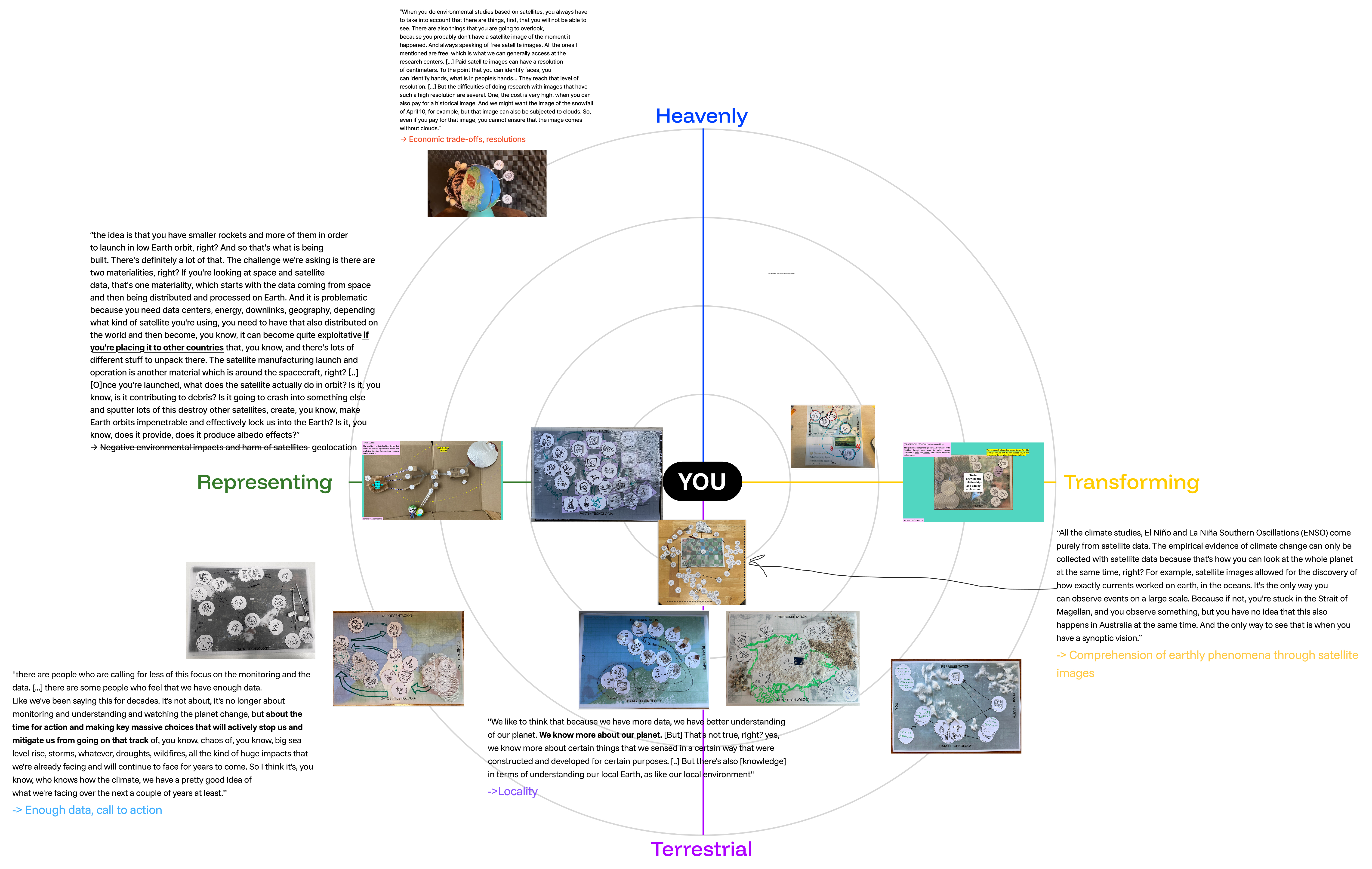
Figure 2: Final arrangement of the participants’ observatory stations on the Figma board during the collective interpretation session.