
Geo-spatial Mapping of Health Services in Slums
Geospatial Mapping of Health Services in Slums
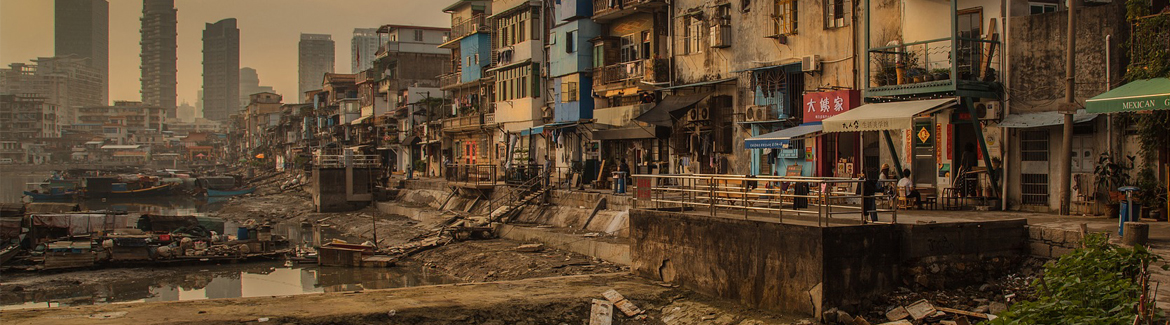
Work Package 1 aims to map current health services and facilities and understand how these are used by people living in seven slums across Africa and Asia. Specific objectives for this work package are:
- To produce accurate maps of slums through the combination of digitisation of Earth Observation satellite imagery and participatory mapping
- To map geo-spatially health care service provision for slum residents and identify accessibility patterns
The project will deliver the following outputs:
- Accurate geo-spatial data about each of the slum sites, stored in the OpenStreetMap database, available for the other work packages, and open access for other organisations.
- Detailed mapping of current healthcare services used by residents and accessibility metrics for the seven slum sites.
- Integrated geospatial database of maps (WP1) and survey results (WP2), which will be used in the analyses of WP4.
- Printed maps of slums to be used in workshops with local residents, planners and other policy makers in WP5.
NIHR Global Health Research Unit on Improving Health in Slums
The Institute for Global Sustainable Development is partnered with the NIHR Global Health Research Unit to deliver a key work package as part of the Unit's research into health services in slums. The wider project aims to:
- Map current health services and facilities and understand how these are used in seven slums across Asia and Africa.
- Identify costs associated with how health services run in each site including informal providers and the quality of these services as well as identifying costs to the patient and their households.
- To systematically update our knowledge on disease prevalence in slums, current healthcare provision models in slums and elsewhere in cities to include services which help to prevent disease, and general literature on financing and designing health services in low and middle income countries.
- To generate viable options for health service delivery in slums and cost these options relative to likely benefits.
- To work with decision makers and slum communities in designing the models of health service delivery, with a view to a subsequent evaluation of effectiveness and costs of viable options.
Research Focus

With the availability of very-high-resolution satellite imagery, the use of remote sensing methods for slum mapping has become increasingly widespread. However, current methods are not capable of a fully automatic identification of slums at a global level, largely due to the limited contextual knowledge, the diversity of slums across the globe and difficulties in capturing slum dynamics. To better capture such contextual factors, humanitarian and pro-poor organisations have been using collaborative methods for slum mapping based on crowdsourcing/Volunteered Geographic Information platforms (e.g. OpenStreetMap) with “ground-truthing” via enumerations and participatory mapping with local residents.
The combination of data digitised by lay volunteers based on optical satellite imagery with quality assurance mechanisms has been shown to be able to produce accurate geographic data that can be used in more precise spatial analysis. These methods can thus be profitably exploited to generate accurate geographic data about slums that will enable detailed spatial analysis of the current provision of healthcare services to slum residents and accessibility patterns.

